|
North Tyneside
Sat. 3rd Nov., 2001
|
 |
 |
|
Wallsend, as it name suggests, is at the end of Hadrian's Wall, built by the Romans to keep out the marauding
Scots and Border Reivers from their most northerly empire outpost.
Modern Wallsend dates from the last quarter of the
18th century. Its shipbuilding pinnacle came in 1906 with the launch of the "Mauretania" at the Swan Hunter yard. Its location, clear of bridges and with a deep channel yet close enough to the major
transport links made Wallsend a perfect location for industrial and housing development. |
|
|
|
|
|
 |
 |
|
On the south west corner of the cross-roads is the 1900 brick built college. The Station and river are to the right.
That new 1960s box building covers a paved area that was part of the original town plan. Pedestrians and shoppers now have the vast frontage to the Forum to move around free from the motor car. |
|
 |
|
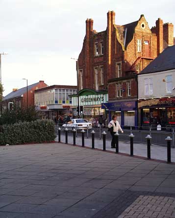
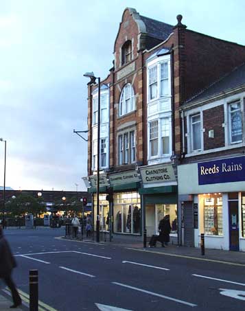
On the opposite corner is the imposing frontage of "Central Building", erected in 1902.
In this view the low
part of The Forum development can be seen beyond that paved area that was the previous site of a bank and a cinema.
Wallsend, thought of by many, as being part of Newcastle upon Tyne, has never been
absorbed into its larger neighbour. It is the administrative centre for the borough of North Tyneside, an expansion of the original Wallsend Borough brought about by the 1971 Local Authority restructuring.
The town is linked to the east with the fishing centre of North Shields and the leisure resort and posh housing of Tynemouth. |
|
|
|
|
 |
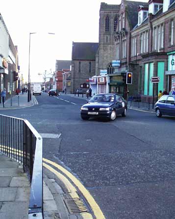
The southern view from this junction is the route to main entrance to Swan Hunters yard. The now silent dock, its
skeletal crane fingers pointing accusingly now unmoving, is an eerie sight.
The college is on the right, then St. Luke's church and the red brick Masonic Hall. The rail bridge adjacent to the station
is just visible.
The rail link is now part of the Tyneside Metro, a modern and clean electric rapid transit system conceived and engineered by the fledgling Passenger Transport Authority in the 1970s.
|
|
 |
|
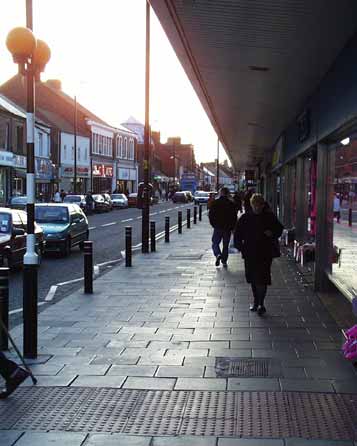
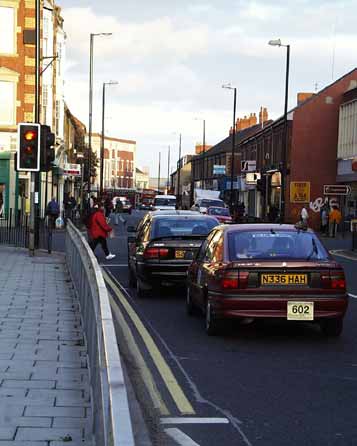
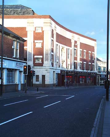
19th century road layouts could not foresee the increase in the size and proliferation of the motor car. This is
the High Street and it is a traffic bottleneck for most of the working day.
This eastward view, with the Central Building and high structures on the left and lower two storey buildings on the right
shows how the original planners attempted to allow the southern sunshine to penetrate the street.
The Borough Theatre in the distance basks in the afternoon sunshine.
That large number plate
screwed onto the bumper of the car in the foreground shows the licence number of a North Tyneside taxicab. |
|
|
|
|
 |
 |
|
During the early 1970s I moved to Newcastle and my job as a bus driver brought me here to Chestnut Street a few
times a day on routes 34 and 35. This ten minute service traversed the city going through Walker, the Quayside, and West Road, to Denton Square at the then western edge of the city.
The fare in 1975
from here to Newcastle centre was 16p, and for the whole route to Denton Square 22p. Today's minimum fare is 38p, the similar trip to Newcastle now costs £1.80!
All bus routes now congregate around
the new bus station adjacent to the Metro Interchange. |
|
|
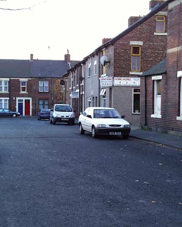
On the opposite side of the High Street in Woodbine Avenue those two small rectangular barred windows and narrow
doorway are the remains of the Tyneside bus sub depot and canteen. At the time, part of the Northern group, Tyneside buses were green and ran without route numbers from here to Croft Street in Newcastle.
Although working for a rival company, we PTE drivers were welcome here for an early morning cup of tea and a dollop of greasy spoon fare. |
|
|
|
|
 |
 |
|
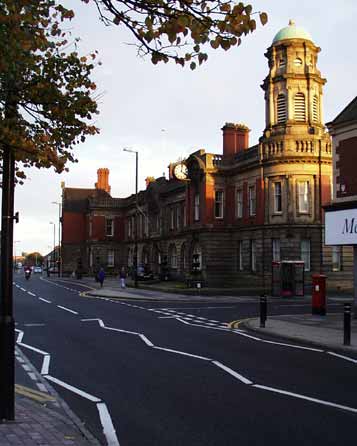
Here at the junction with Park Road is the imposing 1900 Borough Theatre. It was converted to cinema use with the
coming of sound, but does not appear to have fallen for the headlong rush to bingo that was the fate of many cinemas in the late 1960s and 1970s.
The lower floor and foyer area are now an amusement
arcade, the offices seem to be in occasional use, but the main auditorium seems silent.
This well appointed building stands resplendent, as if waiting renewal and new audiences. Not a realistic
expectation, however. A combination of whizz-bang multiplex auditoria and the bug eyed television has long since spelt the end for venues such as this. |
|
 |
|
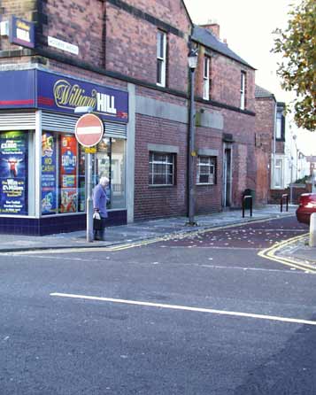
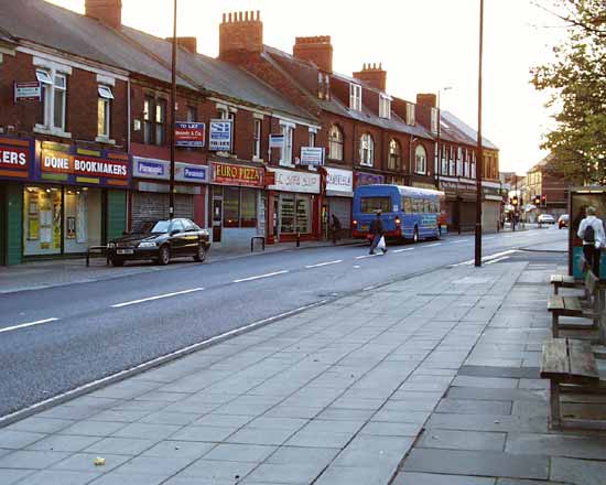
The eastern High Street is busy with small traders offering second hand goods, repair services, fast food, and the
now luxurious betting shop.
Once forbidden to show their interior from the street, it is now possible to glimpse the customers seated at tables surrounded by live video feeds and brightly coloured
decor.
Further east is the Council headquarters, built in the late Victorian style in 1902. To the rear of the offices the municipal builders erected a Fire Station, Public Baths and a school.
The red brick chimney belongs to the unrelated Coach and Horses public house. |
|
|
|
|
 |
 |
|
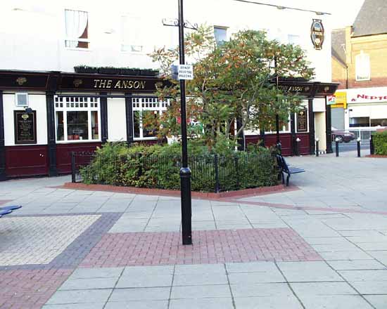
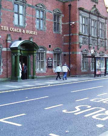
This now fading ornate structure is now only partly in use as a drinking palace.
This is the location of a
much earlier coaching house where travellers were billeted overnight and horses could be stabled.
When the present building was put up in 1908 those coaching days were at an end, but this design
includes references to Tudor and Jacobean proportions and details, Classical triangles and Ionian columns and the then ultra modern curves.
Panels under the first floor windows illustrate cavorting
cherubs that seem out of place on a temple to the demon drink. |
|
|
|
 |
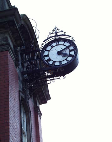
The municipal clock on the front of the Town Hall is still in working order. The wrought iron supports and access
ladder have been replaced, and the workings have been modernised and it no longer lights up at night, but it contiues to keep this neighbourhood rooted in the 19th century.
The majority of Wallsend
residents live in early 20th century housing, a high proportion of which are Tyneside flats. Newer housing to the north with a few high rise blocks symbolise 1960s optimism and was the setting for the BBC
Television series "The Likely Lads".
Excavations at Segedunum
and the opening of the Roman fort mean Wallsend remains in the public eye. |
|
 |
|
Of all of the parts of the Tyneside region Wallsend was dealt the cruellest and double blow. Firstly the
unnecessary and politically motivated demise of the shipbuilding industry threatened the local community and economy. Secondly the suffering was prolonged as one rescue plan after another became at first the
saviour then later the grim reaper in a roller coaster of community manic depression.
Where in other places the pain was swift, Wallsend lingered in death throes and hopelessness for a riotously long
time. That it is now emerging more optimistic is not only a reflection of the injection of Government and EEC cash but also the natural resilience of the people here. |
|
|
 |
 |
|
Site and contents (unless otherwise stated) © Tim. Pickford-Jones and Timmonet, Newcastle upon Tyne,
United Kingdom. |
|
 |
|
|
 |
|
If you should arrive here via a search, or be missing the navigation on the left hand side, click this button.
|
|

