|
|
|
Furthering Education
Sat. 8th Sept., 2001
|
 |
 |
 |
|
John Hunter Rutherford, a preacher, founded the first school of Science and the city extended it in new Bath
Lane premises opened in 1894. In nearby Maple Terrace the grand Royal Grammar School building was taken over by Rutherford Girls' School. This in turn moved to new premises at West Road in 1958.
Rye Hill is a straight road extending for .75km (.46mi) from Elswick Road in the north to Scotswood Road near the river. |
|
 |
©1997 West Newcastle Local Studies. |
|
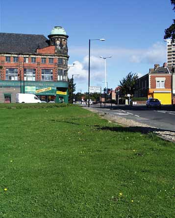
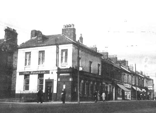
Pictured here in 1956, the Fountain was a popular watering hole at the junction of Rye Hill and Scotswood Road. By this time
the once affluent street was in multiple occupancy and the pub was used by actors from the nearby People's Theatre, now a car park for the
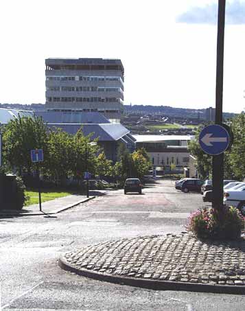
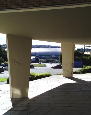 College. Today's view, from the southern edge of
the College, shows the Fountain corner at the point of the new roundabout, with the Newcastle Arena beyond. College. Today's view, from the southern edge of
the College, shows the Fountain corner at the point of the new roundabout, with the Newcastle Arena beyond.
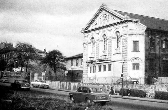
The People's Theatre occupied an abandoned Presbyterian church from 1929 until 1962
when it moved to a larger theatre venue at Stephenson Road, Heaton. The old site was where the car park starts, at the end of the grassy patch on the left.
The stilts support the southernmost building in the
College complex located on the site of a previous Baptist church, pictured below, latterly used by David Allen Poster contractors until its demolition in 1972 to make way for the nearby Parsons Building, erected in 1973.
|
 |
©1997 West Newcastle Local Studies. |
 |
©1997 West Newcastle Local Studies. |
 |
|
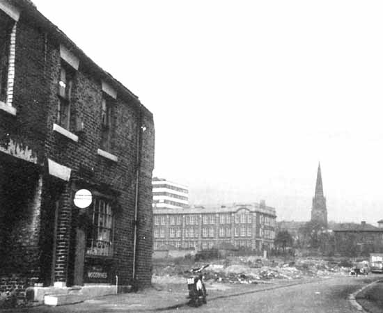
Above, in 1967, Elswick Terrace East was demolished revealing Cambridge Street School, with its playground on the roof, and the
newly built Charles Trevelyan Technical College on the site of the old Rutherford School. The spire of St Mary's
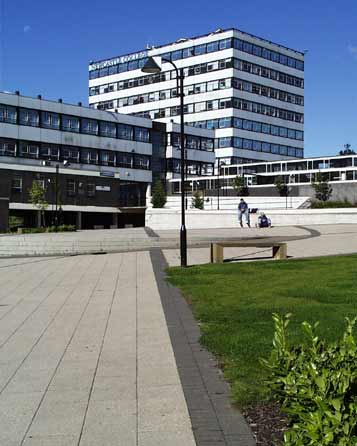 Church at the junction of Rye Hill and
Westmorland Road, is now the site of the College Sports Hall. Church at the junction of Rye Hill and
Westmorland Road, is now the site of the College Sports Hall.
Today's view is from a little further up the hill, and features the central plaza with the Rutherford building on the left,
continuing the legacy of that first school, and the Charles Trevelyan Technical College building, the starting point for this complex.
The College of Further Education was established in 1956 and
amalgamated with the Technical College in 1972 to form the College of Arts and Technology. The present name, Newcastle College, came in 1988 to bring it in line with Newcastle University and Newcastle Polytechnic. This
latter institution has since become the University of Northumbria at Newcastle. |
|
|
 |
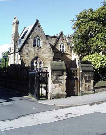
Amid the 1960s wholesale demolition this little building survived. St. Mary's Hospital Almshouses now nestle in a
tree lined oasis It is the only religious building remaining in Rye Hill from the five that existed in 1900 in the stretch between Scotswood Road and Westmorland Road.
The gates to the left lead to
the car park, on the site of the old Physical Laboratory, and entrance to the Trevelyan building.
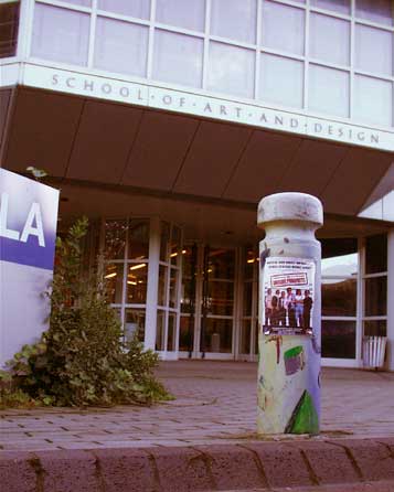
On the opposite side of Rye Hill is the Art and Design department, one of the newest building on the
complex, being erected in 1985. This was named Nelson Mandela House, but this name was not widely used, being considered too "politically correct" until that great man's release from prison in 1990. The
building now wears its name with pride, how things change!
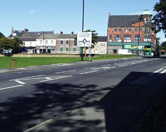
The view from Westmorland Road looking south shows the low Mandela house and the high rise Parsons building behind. It is no longer possible
to drive to Scotswood Road from here.
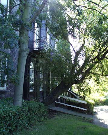
The grassy patch on the left is the remains of the front lawn of the St. Mary's vicarage. This Victorian pile was absorbed into the next door Rye Hill Hospital
during the early part of the 20th century.
This was a maternity unit and small convalescent centre until its closure in the late 1960s. It was taken over by the college shortly afterwards.
Regrettably the building fabric is neglected and crumbling and does not reflect the millions spent on the College as a whole.
Those trees seem accidental and are far to close to the foundations. I
suspect that unless they are removed soon costly remedial work will be required to prevent the buildings from being undermined.
An alternative view might be to consider it a deliberate act to render
the buildings so beyond saving that there would be no question of their being listed and saved for the future. The College could then flatten this part of the site to make way for a more appropriate and less
expensive structure.
Would anyone mourn such a loss? |
|
 |
|
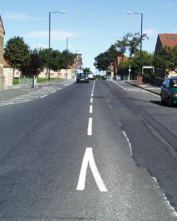
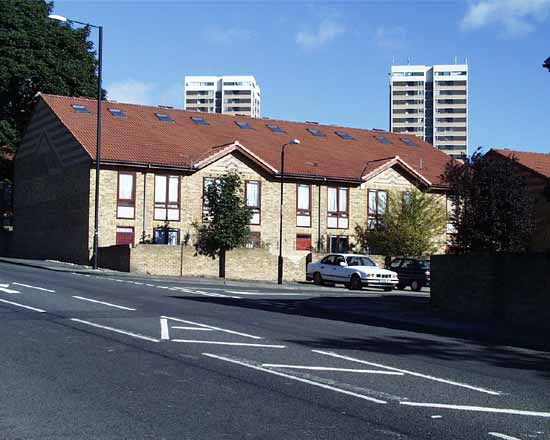
Looking north from the junction with Westmorland Road is quite different. It was always residential from here.
Long gardens stretched in front of Victorian terraced town houses on the right. Market gardens and glasshouses occupied the land on the left. This is still broadly the plan today, with the addition of
St. Paul's Primary School, bounded by a high fence.
The modern housing is arranged in neighbourhood squares but is not the most popular location with prospective residents. |
|
|
 |
 |
 |
|
Rye Hill ends at the junction with Elswick Road, although the thoroughfare continues to West Road along Elswick Row.
Rye Hill also sports some traffic calming measures with pedestrian operated traffic lights at a pinch point. Elswick Road buses were diverted up Rye Hill from their traditional route of Westgate Hill
during the construction of the new St. James' Boulevard in 1997. Since then, this diversion has become a permanent feature and the people here at last have a service.
Rye Hill has changed from
Victorian snob appeal to open to all. Its green space, its affordable housing, and not least the College are truly the city spirit in action. |
|
|
 |
 |
|
Site and contents (unless otherwise stated) © Tim. Pickford-Jones and Timmonet, Newcastle upon Tyne,
United Kingdom. |
|
 |
|
|
 |
|
If you should arrive here via a search, or be missing the navigation on the left hand side, click this button.
|
|



 College. Today's view, from the southern edge of
the College, shows the Fountain corner at the point of the new roundabout, with the Newcastle Arena beyond.
 Church at the junction of Rye Hill and
Westmorland Road, is now the site of the College Sports Hall.