|
Clear Skies
Fri. 16th Nov., 2001
|
|
Benwell, until 1904 a separate Urban District, lies 3 km west of the city centre. During the early 19th century
the washer women of High Cross were in great demand because of the sunny breezy fields.
That situation changed
radically in 1847 when Sir William Armstrong expanded his armament works in neighbouring Elswick. During the following ten years the workforce doubled and new housing, firstly in Elswick and then later South
Benwell was created to house this burgeoning workforce.
The main route through the village of Benwell was Adelaide Terrace, a continuation of Elswick Road, leading to leafy Benwell Lane.
|
 |
|
|
|
|
|
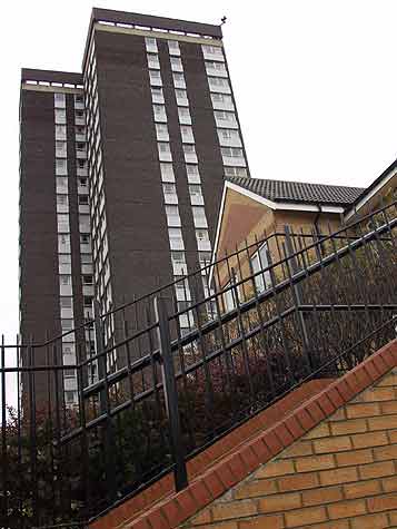
A lot of that 19th century housing has been cleared and replaced by open spaces, but today some Benwell residents
rise vertically in this 1960s solution to high density housing.
Thankfully, Adelaide House is the only truly high rise in the neighbourhood, and now provides a perfect perch for the high powered
police spy cameras ready to follow activity on the ground.
Previous mass employers, in addition to the war factory, were iron, lead, glass goods made in nearby factories, as well as the brick works
and of course mining. Today's Benwell workers are likely to travel out of the immediate area, and if working in the village will be engaged in services. There is now no manufacturing here. |
 |
 |
 |
|
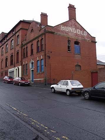
In Beech Street, the easterly edge of Benwell, is the now derelict Sungold Bakery. This massive Victorian undertaking
provided loaves for the growing city. The nearest section is the office block, the bakery proper extends up the hill, and includes a distribution centre and loading bay with space for many carts.
Until recently this building was let out to small businesses such as second hand cars and wrought iron fabrication. Now even this peripheral industry has gone.
A month ago bored kiddies with too much
school holiday set a blaze that was mercifully extinguished before it could destroy the whole structure. However the future of this site must be in question as this vandalism continues. |
|
|
© Newcastle upon Tyne City Library |
|
 |
 |
 |
|
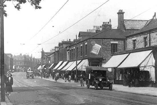
The top picture shows Adelaide Terrace in 1935. Here the shops all have flats above them, and to the left just out of
sight was the newly built Sutton Trust Dwellings on the site of a previous Nursery Garden.
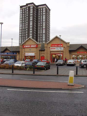
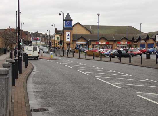
The lower view from the same spot reveals the space cleared in the late 1960s for the ill fated shopping
centre. Its concrete caverns became a haven for petty crime and shoppers avoided it. The more recent and spacious design has been generally welcomed by residents and retailers.
Sutton's Dwellings were
also totally rebuilt during the late 1990s and the rental flats are now more airy than their gloomy dense predesescors. |
|
|
|
|
 |
 |
|
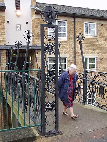
Here is the entrance to Manisty House, retaining one of the original names. Instead of having the access to the south
causing shoppers to have to traipse around the edge and up a flight of steps and a narrow alley, this walkway bridges the gap on what is quite a steep slope.
Whilst these new flats have been designed
to be more attractive than the previous ones, this ornate ironwork and the appearance of the drawbridge over the moat adds to the feeling of security that was previously lacking.
The Local Council and
police have been keen to establish Neighbourhood Watch schemes and Sutton's Trust has incorporated naughty teenager and thief counter measures. |
|
 |
 |
|
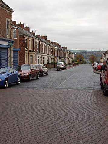
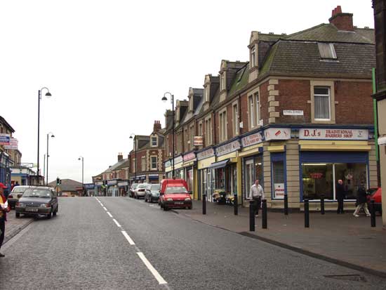
The older shops along Adelaide Terrace date from around the turn of the 20th century and were part of the
redevelopment of South Benwell with its long straight parallel streets running between here and Scotswood Road to the south.
The streets were named after the Buddle and Atkinson family, Gerald, Hugh,
Emily, Clara, Joan, Ethel Frank, Maria and Caroline.
The widest of these was Clara Street seen here. All that remains now is the flat section between Adelaide Terrace and Armstrong Road. From here it
plunged down the steep slope to the riverside.
It was in this street in 1903 that the famous Soviet spy, Rudolf Abel (real name William Fischer) was born. From here also his father, Genrich, actively
smuggled arms to Russia and spent 20 years recruiting factory workers into communist cells. The family moved to Moscow in 1921.
Rudolf Abel was arrested in America having sent atom bomb secrets to Russia and was eventually exchanged for US spy plane pilot Gary Powers in 1960.
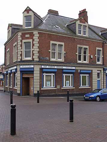
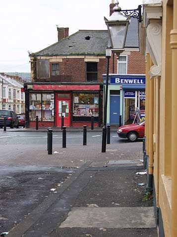
The shops along
Adelaide Terrace were given a long needed facelift in 1989. Millennium money was spent in cleaning the exteriors and giving all the fascias a common style, with painted sign writing rather than the gaudy
plastic mixture that existed before.
The regeneration of Benwell has yet to be completed, but this cosmetic start coincided with a visit from the Princess Royal, Princess Anne |
|
|
 |
 |
 |
 |
 |
|
© West Newcastle Local Studies Group |
|
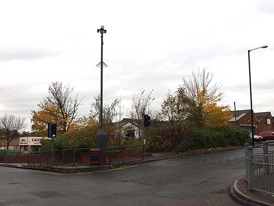
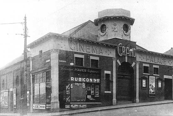
On the corner of Condercum Road and Benwell Lane the "Lop" or Grand Palace Cinema was one of two sitting opposite each other.
This was the down to earth and somewhat older venue being built in 1911. its basement electric generator could be heard rumbling during quieter passages! It closed as a cinema in 1956 and was a Ferodo Brakes warehouse
for many years before being demolished, along with Block's Garage next door, to make way for a Presto supermarket car park in 1982. Presto has gone, victim to the more convenient new shopping centre, and the scene below
shows the site today. |
|
|
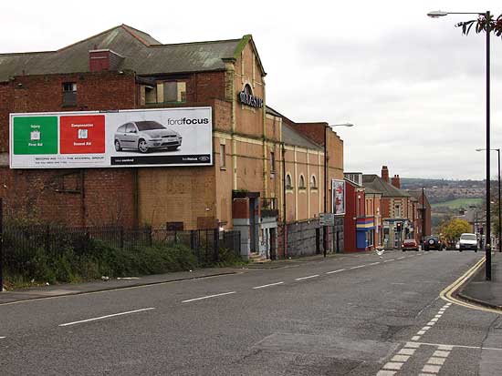
The Majestic, opened in 1927, still stands today. It was equipped as a theatre but was used as a cinema from 1930 until 1961 when
it was converted to Bingo. The fly tower at the far end was cut short and the ornate canopies over the entrances have long ago succumbed to corrosion and neglect. It now stands idle. |
 |
 |
 |
|
© Newcastle upon Tyne City Library |
|
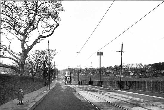
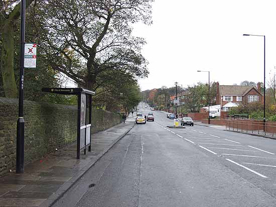
Another before and after here. Above is a 1929 view looking west along Benwell Lane from the entrance to St. James' church, the
churchyard wall is on the left. The tram terminated at Delaval Road, just out of sight on the horizon. The allotments to the right are still there today, but the houses, built in 1948, obscure the view in today's
picture. |
|
|
 |
 |
|
Benwell remains a predominantly working class area but one that has adapted to the new reality of high unemployment,
petty crime, and neglect.
During the Thatcher years, its residents lived in fatalistic despair, but putting a lie to the Tory Witch of the South's proclamation that, "there is no such thing as Society"
Now that a little cash has been spent on improving the fabric of both the built environment and the living conditions, and the Local Council is now allowed to provide for its local residents the
people are happier. That there are still things that need improving is not in dispute; today's question is when will Benwell become prosperous once more? I suspect not until the people here feel needed and
respected. |
|
|
 |
 |
|
Site and contents (unless otherwise stated) © Tim. Pickford-Jones and Timmonet, Newcastle upon Tyne,
United Kingdom. |
|
 |
|
|
 |
|
If you should arrive here via a search, or be missing the navigation on the left hand side, click this button.
|
|


